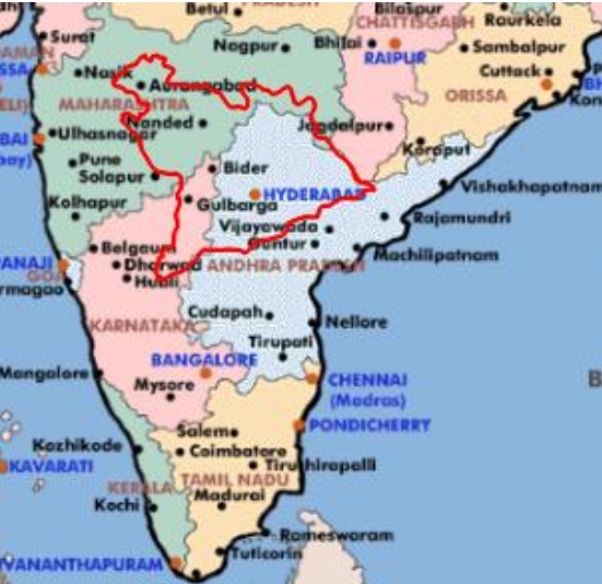
The area outlined in red color represents the Hyderabad state, super imposed over today’s India map. Covering an area of around 82,600 square miles (212,000 km²), Hyderabad state was not only the largest but also the most important native state of India, administered directly by the Governor General of India. Hyderabad state included Telangana, 4 Kannada districts in Gulberga division & 4 Marathi districts in Aurangabad division. It was liberated from Nizam rule in on 18 September, 1948 (for full details see Liberation of Hyderabad).
Until the end of 1949, Major-General J.N.Chaudhuri was the Military Governor of Hyderabad. The government of India appointed M. K. Vellodi as a Chief Minister of Hyderabad state in 26 January 1950 (Republic day) till 6th March 1952. After 1952 general elections, Burgula Rama Krishna Rao took charge as Chief Minister of the Hyderabad state.
